|
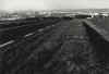
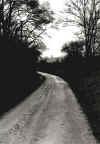
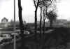
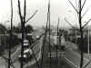
During the winter 2000-01, a French environmental group asked JS Cartier to do a photographic survey of the interface where the country meets the city of Auxerre, in Burgundy. The aim was to stimulate an increased awareness of the existing greenbelt among city planners and dwellers, to protect natural areas, add to them and limit the encroachments of building projects.
So far (2002) this work has only been shown to local architects and urban planners.
|